Concepts · For everyone
How to Measure a Stockpile: Tape, Formula, Laser, Drone and Phone Methods Compared
Every pile of gravel, sand, mulch, soil, salt or wood chips is money sitting on the ground. Here is how people actually measure one, what each method costs, and how close each one gets.
In short
- A stockpile’s volume is the space between its surface and the ground underneath. Every method is a way of describing those two surfaces.
- A tape and the cone formula cost nothing and take ten minutes, but they assume a tidy cone. On a real pile expect to be off by 15–30%.
- Laser, drone and phone scans measure the true surface. Done properly, they land within a few percent of the real volume.
- Volume becomes tons through density, which moisture can change by 10–20%. Check any method against a known truck load when you can.
What you are really measuring
To measure a stockpile you need two surfaces: the top of the pile, which you can see, and the ground beneath it, which you can’t. The volume is whatever sits between them. The top surface is where most of the effort goes, but the hidden base is where most of the disagreements come from. A survey that assumes a flat base under a pile dumped on a slope, or over last year’s leftovers, will be wrong no matter how good the scan of the top is. We cover that trap in how accurate a stockpile measurement really is.
Volume is quoted in cubic yards (27 cubic feet) in the United States and cubic meters almost everywhere else. Weight comes afterwards, from the material’s density, which is a second measurement in its own right. Keep the two steps separate and you will always know which one is responsible for a surprise.
Method 1: A tape measure and a formula
The oldest method still works for a rough answer. Pace or tape the base of the pile to get its diameter, hold a pole or a level line against the pile to get its height, and treat it as a cone:
Volume = ⅓ × π × radius² × height. In feet, a handy shortcut is 0.2618 × diameter² × height, which gives cubic feet; divide by 27 for cubic yards. A pile 30 feet across and 9 feet high works out to 0.2618 × 900 × 9 ≈ 2,120 cubic feet, or about 78 cubic yards. Long piles built by a loader are closer to a ridge: half the width, times the height, times the length, plus a cone on each end. The stockpile volume formula guide walks through each shape with worked examples and angle-of-repose tables.
The weakness is the word “treat”. Real piles have flat tops where the loader drove, scalloped faces where material was taken out, and bases that wander. Each of those is a departure from the cone, and they add up. Fifteen to thirty percent is a fair expectation, which is fine for a purchase order and not fine for a year-end inventory.
Method 2: Counting the loads
Many yards track piles by arithmetic rather than measurement: tickets in, tickets out, and whatever is left must be the pile. Scale tickets are reliable for weight. Loader bucket counts are not, because a “bucket” is heaped differently every time and a 3-yard bucket rarely carries 3 yards. Material also swells when it is dug and settles when it is stored, so the same tonnage occupies different space on different days; see bank, loose and compacted yards.
Load counting is still valuable as a cross-check. If the tickets say 400 tons went in and the pile measures 250, something is wrong with the pile, the tickets or the density, and now you know to look. For a single delivery, checking a delivery against what you ordered is the same idea at small scale.
Method 3: Laser survey
A surveyor with a total station or a laser rangefinder shoots points across the pile and around its toe, and software turns those points into a surface. A terrestrial laser scanner does the same job with millions of points instead of a few dozen. The result is a measured surface rather than an assumed one, so the shape problem goes away. What remains is coverage: the back of a pile is in shadow from the front, so a scanner needs several setups to see everything, and a sparse point survey can miss a hollow entirely.
Accuracy on a well-covered pile is within a few percent, with the usual caveat about the base. The cost is a crew visit, which is why laser surveys tend to happen quarterly or annually rather than whenever someone wants to know. For a contract quantity or a legal dispute, a surveyor’s stamped volume is still the gold standard.
Method 4: Drone photogrammetry or LiDAR
A drone flies a grid over the site taking overlapping photos. Structure-from-motion software finds the same features in many photos, solves for where the camera was for each one, and builds a dense point cloud and a surface; ground control points or an RTK receiver pin that model to real coordinates and scale. Drone LiDAR skips the photos and measures range directly, which helps on dark, uniform material where photos lack texture.
The evidence base here is good. A 2020 study from the Estonian University of Life Sciences benchmarked drone photogrammetry against terrestrial laser scanning and found every photogrammetric model within 4% of the laser-scanned volume, even without ground control points, and Pix4D’s accuracy white paper puts well-controlled drone surveys within a few centimeters of surveyed checkpoints. The costs are the drone, a Part 107 pilot, mapping software and processing time, and the limits are airspace, weather and roofs: a salt shed or a covered bay is out. For when the drone wins and when it doesn’t, see drone vs phone for stockpile measurement.
Method 5: Walk around it with your phone
The same photogrammetry now runs on a phone. You walk once around the pile keeping the whole thing in frame; the app aligns the photos, builds a 3D surface, finds the toe and reports a volume. Scale comes from the phone’s LiDAR when it has one, or from its motion tracking when it doesn’t. In 2013 the Texas Department of Transportation tested an early phone app against LiDAR and GPS surveys and found it within about 1.5% on piles under 100 cubic yards, which is what convinced the agency to use phones for its own inventories.
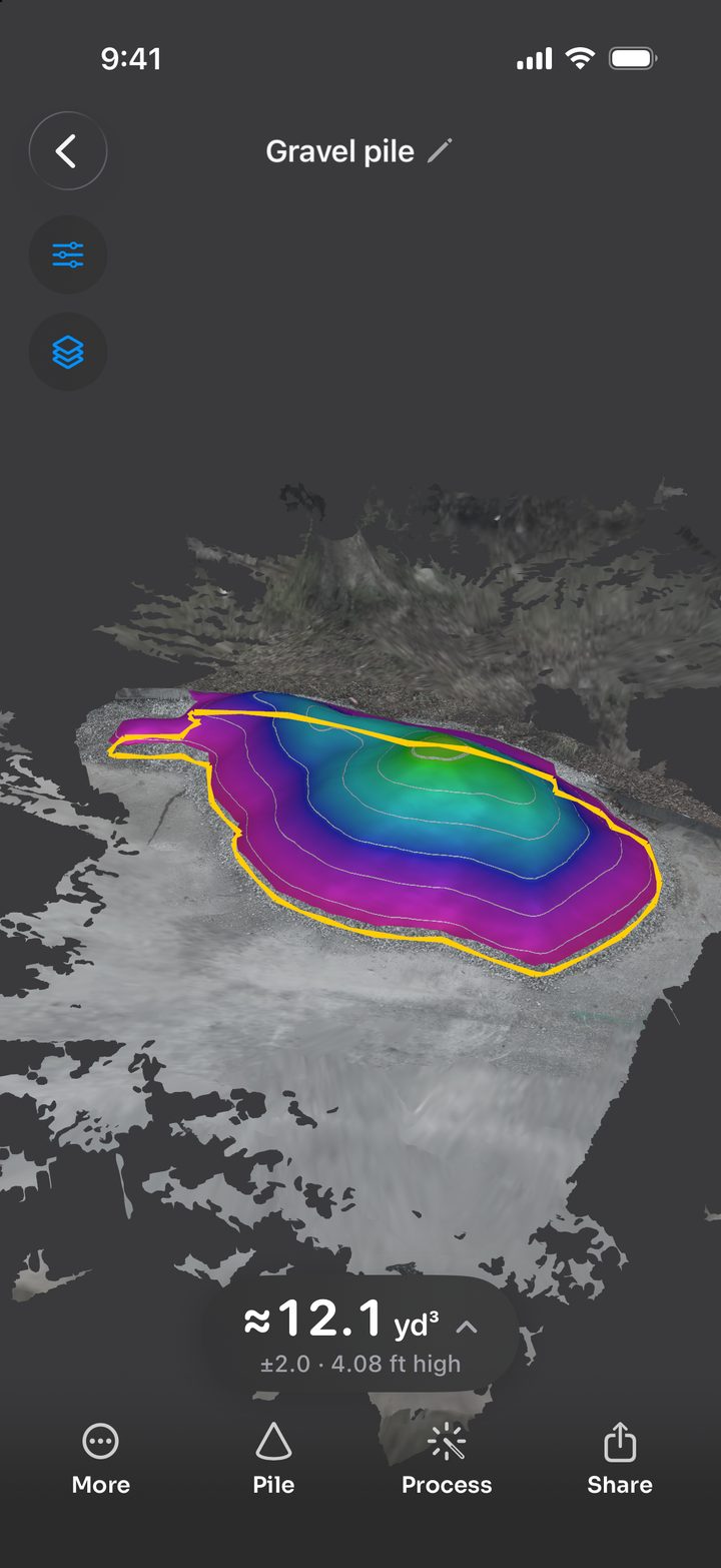
Stockpile Scan is our version of this method: a free iPhone app, no account and no subscription, that processes the photos on the phone and shows every volume with a ± range worked out from that scan, plus plain-language checks such as a walk that didn’t close the loop. LiDAR narrows the range but isn’t required. A walk-around takes a few minutes for a typical yard pile, so it suits monthly counts, delivery spot checks and any pile under a roof. Its limits are the same as any ground-level capture: a very tall pile hides its own top from someone standing at the toe, and a pile hard against a wall can’t be walked all the way around. We compare the apps that work this way in stockpile measurement apps for iPhone.
Which method should you use?
| Method | Typical accuracy on a real pile | Cost | Time | Best for |
|---|---|---|---|---|
| Tape and formula | ±15–30% | Free | 10 minutes | Ordering, quick sanity checks |
| Load counting | Good with scale tickets; ±20% or worse by bucket | Free | Ongoing | Cross-checking a measured volume |
| Laser survey | A few percent with full coverage | A survey crew visit | Hours | Contract quantities, disputes |
| Drone | Within a few percent; under 4% in published tests | Drone, pilot, software | Hours including processing | Whole sites, many piles, tall piles |
| Phone scan | A few percent, reported as a ± range | Free to low | Minutes | Single piles, monthly counts, deliveries, indoor piles |
Accuracy figures assume the base surface is handled correctly; a wrong base can add more error than any of these methods.
From volume to tons
Volume is only half of what the buyer, the seller or the accountant wants. Multiply by the material’s loose density to get weight: ¾-inch crushed stone at roughly 1.35–1.4 US tons per cubic yard turns a 12.1-cubic-yard pile into about 16 or 17 tons; the same pile of shredded mulch would weigh about 4. Densities shift with moisture, grading and how long the pile has sat, so a supplier’s figure beats a generic table. Our density table for gravel, sand, dirt, mulch, compost and wood chips gives ranges for the common materials, and buying by the ton or by the yard explains why the two units never quite agree.
Five habits that improve any method
- Decide what the base is before you measure. Bare pad, last season’s floor, or the ground as it is today. Write it down and use the same choice next time.
- Capture the toe all the way around. The edge of the pile defines the footprint, and a missing edge is a missing slice of volume.
- Measure a still pile. A loader working the far side changes the answer while you take it.
- Check against something you know. A fresh delivery with a scale ticket, or a pile you have scanned twice, tells you how your method behaves on your material.
- Keep the evidence. A dated report with photos, the border you used and the density you assumed is what settles the argument six months later.
Frequently asked questions
What is the easiest way to measure a stockpile?
For a single pile, walking around it with a phone scanning app is the easiest method: a few minutes of walking, processing on the phone, and a volume with a ± range. A tape measure and the cone formula is faster still but only approximates the shape, so expect it to be off by 15 to 30 percent on a real pile.
How accurate is a stockpile measurement?
Tape-and-formula estimates are typically within 15 to 30 percent. Laser surveys, drone photogrammetry and phone scans measure the actual surface and, done carefully, land within a few percent; published drone tests land within 4 percent of terrestrial laser scanning. The base surface under the pile and the density used to convert to tons usually add more uncertainty than the scan itself.
Can I measure a stockpile without a drone?
Yes. A phone scan uses the same photogrammetry as a drone, captured from the ground while you walk around the pile. It works indoors, under roofs and in controlled airspace where a drone cannot fly, and needs no pilot certificate. Very large or very tall piles still favor a drone, which can see the whole top surface.
How do I convert stockpile volume to tons?
Multiply the volume in cubic yards by the material’s loose density in tons per cubic yard. Crushed stone runs about 1.4 to 1.7 US tons per cubic yard, sand 1.3 to 1.7, topsoil 1.0 to 1.3 and mulch 0.2 to 0.4. Moisture can add 10 to 20 percent, so use your supplier’s figure when you have one.

Measure your next pile with your iPhone
Stockpile Scan is free, with no ads, subscriptions or account. Walk around a pile and get its volume, a ± range, a weight estimate and a PDF report, all on the phone.
Any iPhone with iOS 18 or later. LiDAR optional. Learn more about the app.
Related articles
Sources and further reading
- Kokamägi, Türk & Liba (2020): UAV photogrammetry for volume calculations, Agronomy Research
- Pix4D white paper: How accurate are UAV surveying methods?
- ENR: TxDOT proves accuracy of stockpile volume measurement app
- LiDAR Magazine: why the base definition drives stockpile volume disputes
- Engineering ToolBox: stockpile volume calculator